

Map
Brampton Centre (Ontario)
 Download the detailed map in PDF format
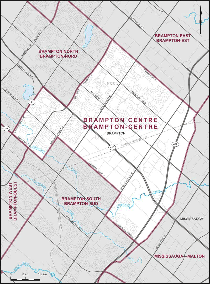
Boundaries description
Consisting of that part of the Regional Municipality of Peel comprised of that part of the City of Brampton described as follows: commencing at the intersection of the southeasterly limit of said city with Hurontario Street; thence northwesterly along said street to Steeles Avenue East; thence northeasterly along said avenue to Kennedy Road South; thence northwesterly along said road and Kennedy Road North to Vodden Street East; thence southwesterly along said street to Main Street North; thence northwesterly along said street to Bovaird Drive East; thence northeasterly along said drive to Highway No. 410; thence southeasterly along said highway to Williams Parkway East; thence northeasterly along said parkway to Torbram Road; thence southeasterly along said road to the southeasterly limit of said city; thence generally southwesterly along said limit to the point of commencement.