

Map
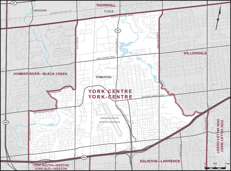
York Centre (Ontario)
 Download the detailed map in PDF format
Boundaries description
Consisting of that part of the City of Toronto described as follows: commencing at the intersection of the northerly limit of said city with Keele Street; thence southerly along said street to Grandravine Drive; thence generally westerly along said drive to Black Creek; thence generally southeasterly along said creek to Sheppard Avenue West; thence westerly along said avenue to Jane Street; thence southerly along said street to Highway No. 401; thence easterly and northeasterly along said highway to the Don River West Branch; thence generally northwesterly along said branch to Bathurst Street; thence northerly along said street to the northerly limit of said city; thence westerly along said limit to the point of commencement.