

Map
Burnaby South (British Columbia)
 Download the detailed map in PDF format
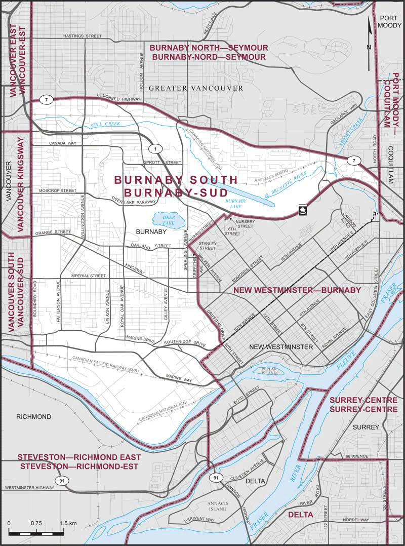
Boundaries description
Consisting of that part of the City of Burnaby described as follows: commencing at the intersection of the westerly limit of said city with Lougheed Highway (Highway No. 7); thence generally easterly along said highway to the easterly limit of said city at North Road; thence southerly along North Road to the Trans-Canada Highway (Highway No. 1); thence generally westerly along said highway to the northeasterly production of Nursery Street; thence southwesterly along said production and Nursery Street to 6th Street; thence northwesterly along said street to Burris Street; thence southwesterly along said street to Walker Avenue; thence southeasterly along said avenue to Stanley Street; thence southerly in a straight line to the end of Griffiths Avenue; thence southerly along said avenue to Griffiths Drive; thence generally southerly along said drive to the southerly limit of said city at 10th Avenue; thence generally westerly and northerly along the southerly and westerly limits of said city to the point of commencement.