

Map
Sudbury (Ontario)
 Download the detailed map in PDF format
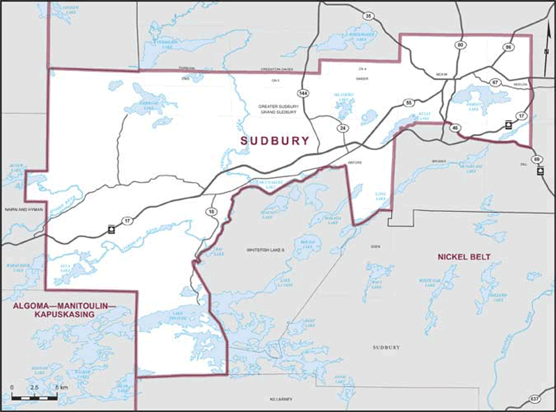
Boundaries description
Consisting of that part of the City of Greater Sudbury described as follows: commencing at the intersection of Highway No. 17 with Highway No. 69; thence generally westerly and northwesterly along Highway No. 69 and Highway No. 46 (Regent Street) to Long Lake Road (Regional Road No. 80); thence southerly along said road to the southerly boundary of the geographic Township of McKim; thence westerly along said boundary to the easterly shoreline of Kelly Lake; thence generally southwesterly along said shoreline to the easterly boundary of the geographic Township of Waters; thence southerly along said boundary and the easterly boundary of the geographic Township of Eden to the southerly limit of said city; thence generally westerly and generally northerly along the southerly and westerly limits of said city to the northerly boundary of Concession 3 of the geographic Township of Fairbank; thence easterly along said boundary and the northerly boundary of Concession 3 of the geographic Township of Creighton-Davis to the westerly boundary of the geographic Township of Snider; thence northerly along said boundary to the northerly boundary of Concession 4 of said geographic township; thence easterly along said boundary to the westerly boundary of the geographic Township of McKim; thence northerly along said boundary to the northwestern corner of said geographic township; thence easterly along the northerly boundary of the geographic townships of McKim and Neelon to the easterly boundary of Lot 7 of the geographic Township of Neelon; thence southerly along said boundary and the easterly boundary of Lot 7 of the geographic Township of Dill to Highway No. 69; thence generally westerly along said highway to the point of commencement.