Brampton Centre
Boundaries description
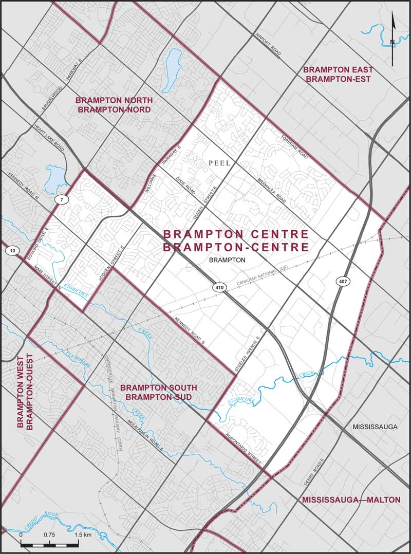
Consisting of that part of the Regional Municipality of Peel comprised of that part of the City of Brampton described as follows: commencing at the intersection of the southeasterly limit of said city with Hurontario Street; thence northwesterly along said street to Steeles Avenue East; thence northeasterly along said avenue to Kennedy Road South; thence northwesterly along said road and Kennedy Road North to Vodden Street East; thence southwesterly along said street to Main Street North; thence northwesterly along said street to Bovaird Drive East; thence northeasterly along said drive to Highway No. 410; thence southeasterly along said highway to Williams Parkway East; thence northeasterly along said parkway to Torbram Road; thence southeasterly along said road to the southeasterly limit of said city; thence generally southwesterly along said limit to the point of commencement.