Etobicoke–Lakeshore
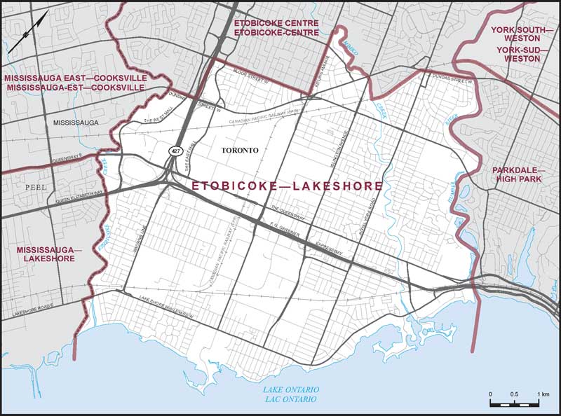
Boundaries description
Consisting of that part of the City of Toronto described as follows: commencing at the intersection of the Humber River with Dundas Street West; thence southwesterly along said street to the Canadian Pacific Railway; thence southerly along said railway to Mimico Creek; thence generally northwesterly along said creek to Kipling Avenue; thence southerly along said avenue to Bloor Street West; thence westerly along said street to Highway No. 427; thence southerly along said highway to Dundas Street West; thence westerly along said street to the westerly limit of the City of Toronto; thence generally southerly and northeasterly along the westerly and southerly limits of said city to the southeasterly production of the Humber River; thence generally northwesterly along said production and the Humber River to the point of commencement.