Parkdale–High Park
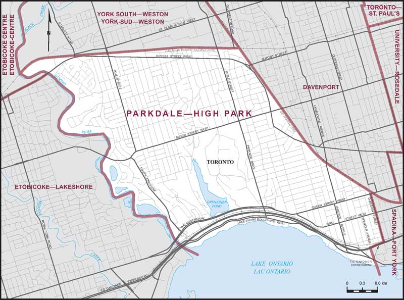
Boundaries description
Consisting of that part of the City of Toronto described as follows: commencing at the intersection of the Humber River with the Canadian Pacific Railway; thence easterly along said railway to the GO Transit Railway situated easterly of Old Weston Road; thence southeasterly along said railway to Queen Street West; thence westerly along said street to Dufferin Street; thence southerly along said street to the F. G. Gardiner Expressway; thence westerly along said expressway to the southerly production of Spencer Avenue; thence southerly along said production to the southerly limit of said city; thence generally westerly along said limit to the southeasterly production of the Humber River; thence generally northwesterly along said production and the Humber River to the point of commencement.