Windsor West
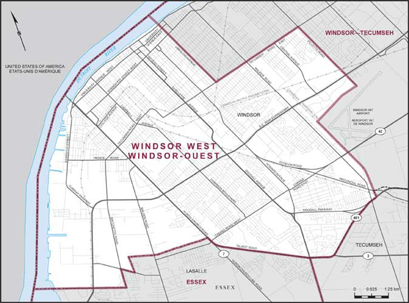
Boundaries description
Consisting of that part of the City of Windsor lying westerly and southerly of a line described as follows: commencing at the intersection of the international boundary between Canada and the United States of America with the northwesterly production of Langlois Avenue; thence southeasterly along said production and Langlois Avenue to Tecumseh Road East; thence easterly along said road to Pillette Road; thence southeasterly along said road and its intermittent productions to the northerly limit of the Windsor International Airport; thence generally southwesterly along said limit to the Canadian National Railway; thence southerly along said railway to the southerly limit of said city.