Winnipeg Centre
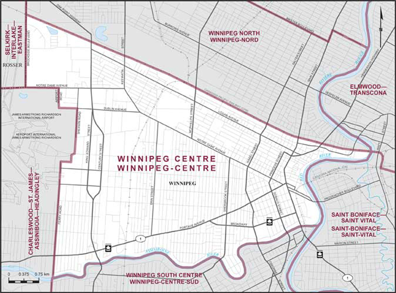
Boundaries description
Consisting of that part of the City of Winnipeg described as follows: commencing at the intersection of the Red River with the Assiniboine River; thence generally westerly along the Assiniboine River to the southerly production of Ferry Road; thence northerly along said production and Ferry Road to the easterly limit of James Armstrong Richardson International Airport; thence generally northerly along said limit to Notre Dame Avenue; thence westerly along said avenue to the westerly limit of the City of Winnipeg (Brookside Boulevard); thence northerly along said limit to the main line of the Canadian Pacific Railway; thence southeasterly along said railway to the Red River; thence generally southwesterly along said river to the point of commencement.