Vancouver Granville
Boundaries description
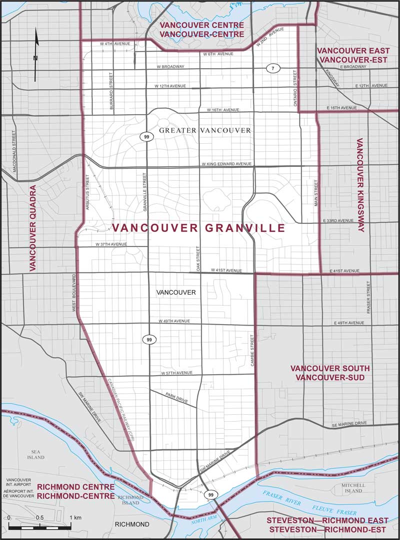
Consisting of that part of the City of Vancouver described as follows: commencing at the intersection of the southerly limit of said city with the southerly production of Cambie Street; thence northerly along said production and Cambie Street to 41st Avenue West; thence easterly along said avenue and 41st Avenue East to Main Street; thence northerly along said street to 16th Avenue East; thence westerly along said avenue to Ontario Street; thence northerly along said street to 2nd Avenue West; thence westerly and southwesterly along said avenue to 6th Avenue West; thence westerly along said avenue to 4th Avenue West; thence northwesterly and westerly along said avenue to Arbutus Street; thence southerly along said street to 37th Avenue West; thence easterly along said avenue to the Canadian Pacific Railway; thence southerly and southeasterly along said railway to the southerly production of Granville Street; thence southerly along said production to the southerly limit of said city; thence generally easterly along said limit to the point of commencement.