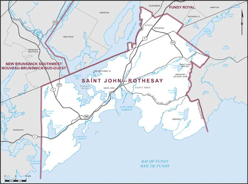
Map
Saint John--Rothesay (New Brunswick)
 Download the detailed map in PDF format
Boundaries description
Consisting of:
- (a) that part of the County of Saint John comprised of:
(i) the City of Saint John;
(ii) The Brothers Indian Reserve No. 18;
(iii) that part of the Parish of Simonds lying southwesterly of a line described as follows: commencing at the intersection of Old Black River Road and the easterly limit of the City of Saint John (that is to say, the Mispec River); thence generally southeasterly and easterly along said road to West Beach Road; thence southerly along said road to latitude 45°13'44"N; thence southerly in a straight line to a point in the Bay of Fundy at latitude 45°12'31"N and longitude 65°50'39"W; and
- (b) that part of the County of Kings comprised of the Town of Rothesay.

