

Map
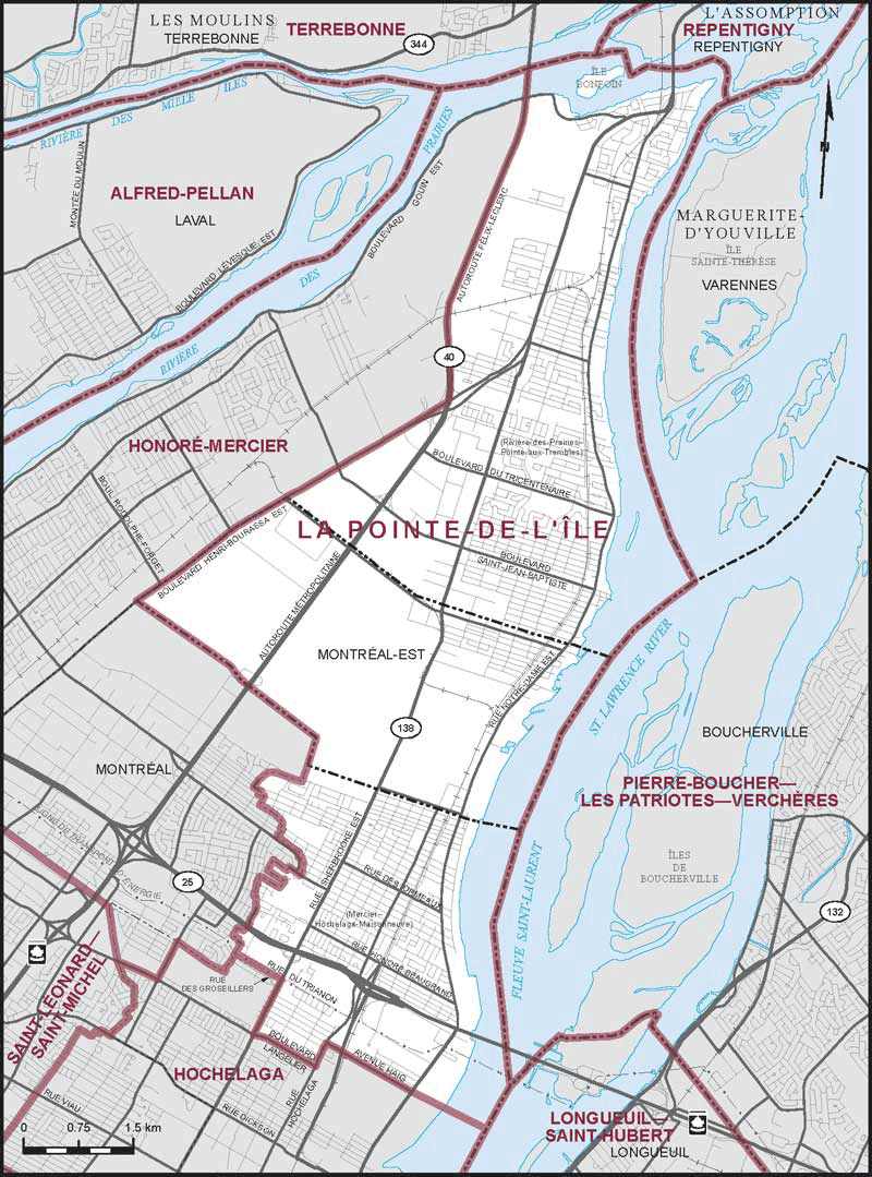
La Pointe-de-l'Île (Quebec)
 Download the detailed map in PDF format
Boundaries description
Consisting of:
- (a) the City of Montréal-Est; and
- (b) that part of the City of Montréal comprised of:
(i) that part of the borough of Rivière-des-Prairies–Pointe-aux-Trembles lying southeasterly and easterly of a line described as follows: commencing at the intersection of the northernmost corner of the City of Montréal-Est with Henri-Bourassa Boulevard East; thence northeasterly along said boulevard to Highway No. 40 (Métropolitaine Highway); thence northerly along said highway to the northerly limit of the City of Montréal;
(ii) that part of the borough of Mercier–Hochelaga-Maisonneuve lying northeasterly of a line described as follows: commencing at the intersection of the southeasterly limit of the City of Montréal with the southeasterly production of Haig Avenue; thence northwesterly along said production and said avenue to Hochelaga Street; thence southwesterly along said street to Langelier Boulevard; thence northwesterly along said boulevard to Sherbrooke Street East; thence northeasterly along said street to the transmission line lying between Trianon Street and Des Groseilliers Street; thence northwesterly along said transmission line to the westerly limit of the borough of Mercier–Hochelaga-Maisonneuve.