

Map
Saint-Léonard--Saint-Michel (Quebec)
 Download the detailed map in PDF format
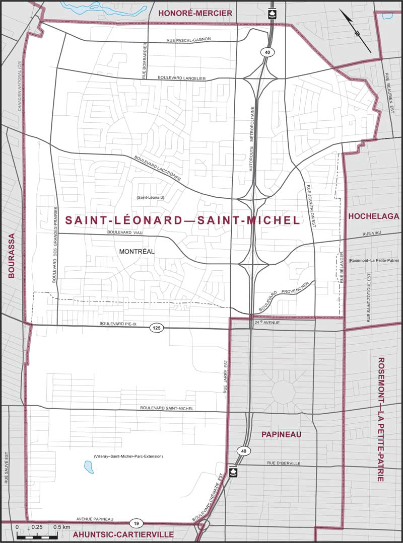
Boundaries description
Consisting of that part of the City of Montréal comprised of:
- (a) the borough of Saint-Léonard;
- (b) that part of the borough of Villeray–Saint-Michel–Parc-Extension lying northwesterly and northeasterly of a line described as follows: commencing at the intersection of the northeasterly limit of said borough (between Provencher Boulevard and 24th Avenue) and Highway No. 40 (Métropolitaine Highway); thence southwesterly along said highway to 24th Avenue; thence northwesterly along said avenue to Jarry Street East; thence southwesterly along said street and Crémazie Boulevard East to the westerly limit of the borough of Villeray–Saint-Michel–Parc-Extension; and
- (c) that part of the borough of Rosemont–La Petite-Patrie lying northwesterly of Bélanger Street.