

Map
Hamilton Centre (Ontario)
 Download the detailed map in PDF format
Boundaries description
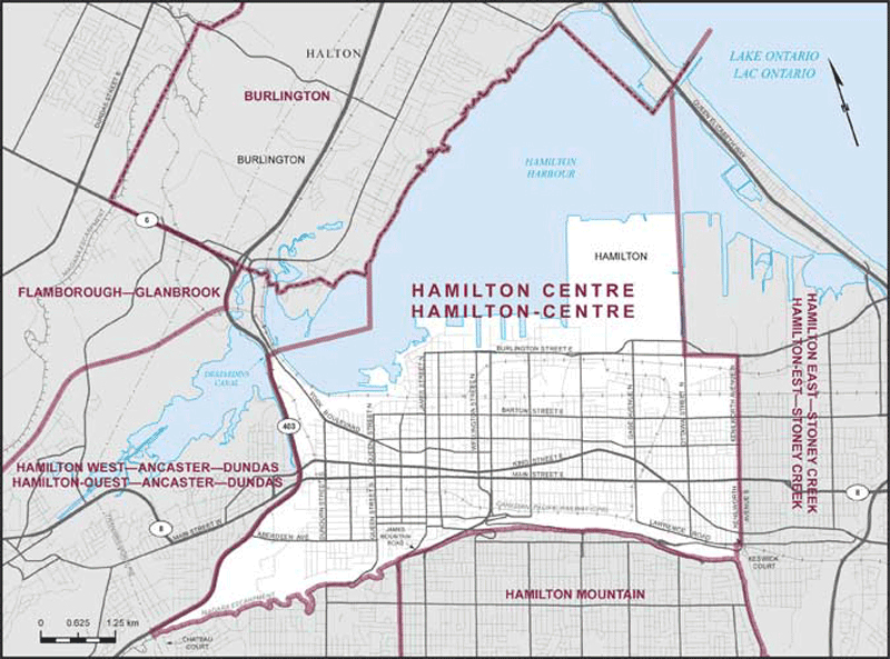
Consisting of that part of the City of Hamilton described as follows: commencing at the intersection of James Mountain Road with the Niagara Escarpment; thence generally westerly along said escarpment to the electric power transmission line situated westerly of Chateau Court; thence northerly along said transmission line to Highway No. 403; thence generally northeasterly along said highway to the Desjardins Canal; thence easterly along said canal and continuing due east in Hamilton Harbour to the northerly production of Queen Street North; thence northerly in a straight line along said production to the northerly limit of said city; thence generally northeasterly, southeasterly and northeasterly along said limit to the northerly production of Ottawa Street North; thence southerly along said production and Ottawa Street North to Burlington Street East; thence easterly along said street to Kenilworth Avenue North; thence southerly along said avenue and Kenilworth Avenue South to Lawrence Road; thence westerly along said road to the southerly production of Keswick Court; thence southerly along said production to the Niagara Escarpment; thence generally westerly along said escarpment to the point of commencement.