

Map
Mississauga Centre (Ontario)
 Download the detailed map in PDF format
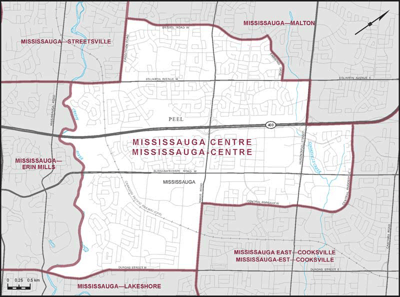
Boundaries description
Consisting of that part of the Regional Municipality of Peel comprised of that part of the City of Mississauga described as follows: commencing at the intersection of Eglinton Avenue West with Hurontario Street; thence southeasterly along said street to Highway No. 403; thence northeasterly along said highway to Central Parkway East; thence southeasterly and southwesterly along said parkway and Central Parkway West to Mavis Road; thence southeasterly along said road to Dundas Street West; thence southwesterly along said street to the Credit River; thence generally northwesterly along said river to Eglinton Avenue West; thence northeasterly along said avenue to Creditview Road; thence northwesterly along said road to Bristol Road West; thence generally northeasterly along said road to Fairwind Drive; thence generally easterly along said drive to Eglinton Avenue West; thence northeasterly along said avenue to the point of commencement.