

Map
Winnipeg North (Manitoba)
 Download the detailed map in PDF format
Boundaries description
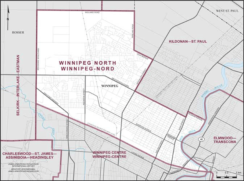
Consisting of that part of the City of Winnipeg described as follows: commencing at the intersection of the Red River with the main line of the Canadian Pacific Railway; thence northwesterly along said railway to the westerly limit of the City of Winnipeg (Brookside Boulevard); thence northerly along said limit to Mollard Road; thence easterly along said road to Pipeline Road; thence southerly along said road to Leila Avenue; thence southeasterly along said avenue to McPhillips Street; thence southwesterly along said street to Inkster Boulevard; thence southeasterly along said boulevard to Main Street; thence northerly along said street to McAdam Avenue; thence southeasterly along said avenue and its intermittent productions to the Red River; thence generally southerly along said river to the point of commencement.