

Map
Calgary Forest Lawn (Alberta)
 Download the detailed map in PDF format
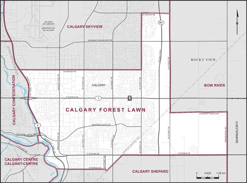
Boundaries description
Consisting of that part of the City of Calgary described as follows: commencing at the intersection of the easterly limit of said city with 17 Avenue SE; thence westerly along said avenue to the Canadian National Railway; thence southwesterly along said railway to the southeasterly production of 48 Street SE; thence northwesterly along said production and 48 Street SE to the easterly production of 26 Avenue SE; thence westerly along said production, 26 Avenue SE and its westerly production to the right bank of the Bow River; thence generally northerly along said bank to the Canadian Pacific Railway; thence northerly along said railway to Memorial Drive NE; thence easterly along said drive to Deerfoot Trail NE (Highway No. 2); thence northerly along said trail to 32 Avenue NE; thence easterly along said avenue to 68 Street NE; thence northerly along said street to 64 Avenue NE; thence easterly along said avenue and its easterly production to the easterly limit of said city; thence southerly, easterly and southerly along said limit to the point of commencement.