Sackville–Preston–Chezzetcook
Boundaries description
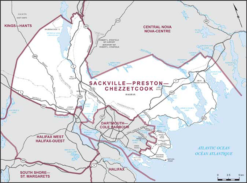
Consisting of that part of the Halifax Regional Municipality described as follows: commencing at a point in Halifax Harbour at latitude 44°37’34”N and longitude 63°33’08”W; thence easterly and southeasterly (skirting northerly and easterly around McNabs Island) to a point in said harbour at latitude 44°37’13”N and longitude 63°30’57”W; thence northeasterly to a point on Main Road at approximate latitude 44°37’28”N and longitude 63°30’43”W; thence northwesterly along said road to Hines Road; thence generally easterly along said road and Caldwell Road to the unnamed brook flowing from Morris Lake; thence southeasterly along said brook to the Trans Canada Trail; thence northeasterly along said trail to the unnamed brook flowing from Bissett Lake; thence northwesterly along said brook and Bissett Lake to a point in Bissett Lake located due west of the intersection of Bissett Road with Bissett Lake Road; thence due east in a straight line to the intersection of said roads; thence northeasterly in a straight line to a point in Cole Harbour at latitude 44°40’01”N and longitude 63°26’47”W; thence northwesterly in a straight line to the unnamed brook flowing from Broom Lake; thence generally northerly along said brook to a transmission line; thence northerly along said transmission line to Highway No. 7 (Windmill Road); thence generally westerly along said highway to Forest Hills Extension; thence generally northwesterly along said extension to a point at latitude 44°44’17”N and longitude 63°33’32”W; thence westerly in a straight line to a point where the Canadian National Railway crosses Marshall Brook at approximate latitude 44°44’21”N and longitude 63°35’09”W; thence southwesterly along said railway to a point at latitude 44°43’00”N and longitude 63°36’38”W; thence northwesterly in a straight line to a point in Anderson Lake at latitude 44°43’26”N and longitude 63°37’16”W; thence northerly in a straight line to the intersection of the Canadian National Railway with Rocky Lake Drive; thence northeasterly along said railway to a point at latitude 44°44’56”N and longitude 63°37’44”W; thence northerly in a straight line to a point on the westerly shore of Rocky Lake at latitude 44°45’03”N and longitude 63°37’45”W; thence generally northerly along said shore to Sucker Brook; thence westerly along said brook to Highway No. 102; thence southwesterly along said highway to Highway No. 101; thence northwesterly along said highway to the Little Sackville River; thence southerly along said river to the Sackville River; thence westerly, northwesterly and northeasterly along said river to the southwesterly production of Beaver Bank Road Connector; thence northeasterly along said production and Beaver Bank Road Connector to Highway No. 101; thence northwesterly along said highway to the northerly limit of the Halifax Regional Municipality; thence generally northeasterly along said limit to Highway No. 102; thence generally southerly along said highway to the unnamed brook flowing into Soldier Lake at approximate latitude 44°50’47”N and longitude 63°34’13”W; thence southerly along said brook and Soldier Lake to a point in said lake at latitude 44°48’18”N and longitude 63°34’15”W; thence easterly in a straight line to a point in Three Mile Lake at latitude 44°48’33”N and longitude 63°29’39”W; thence easterly in a straight line to a point in Porters Lake at latitude 44°48’29”N and longitude 63°22’51”W; thence southerly through said lake to a point in said lake at latitude 44°45’49”N and longitude 63°19’27”W; thence easterly in a straight line to the mouth of the unnamed brook at the western point of Thompson Lake; thence easterly along said lake, Conrod Lake, the brook between Conrod Lake and Chezzetcook Lake, and Chezzetcook Lake to the mouth of the Chezzetcook River; thence southerly along said river to Highway No. 7; thence southerly to Splitrock Point and the southerly limit of the Halifax Regional Municipality in the Atlantic Ocean at approximate latitude 44°37’12”N and longitude 63°09’31”W; thence westerly along said limit to a point in Halifax Harbour at latitude 44°33’43”N and longitude 63°30’00”W; thence generally northerly along Halifax Harbour (passing to the west of McNabs Island) to the point of commencement.