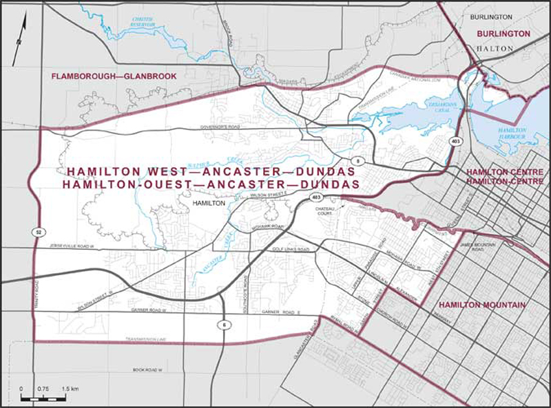
Hamilton West–Ancaster–Dundas
Boundaries description
Consisting of that part of the City of Hamilton described as follows: commencing at the intersection of the northerly limit of said city with Highway No. 403; thence southwesterly along said highway to the Canadian National Railway; thence generally westerly along said railway to Highway No. 52 North; thence generally southerly along said highway and Trinity Road to the electric power transmission line situated northerly of Book Road West; thence generally easterly along said transmission line to Glancaster Road; thence northerly along said road to Garner Road East; thence easterly along said road and Rymal Road West to Garth Street; thence northerly along said street to Lincoln M. Alexander Parkway; thence easterly along said parkway to West 5th Street; thence northerly along said street to James Mountain Road; thence generally northeasterly along said road to the Niagara Escarpment; thence generally westerly along said escarpment to the electric power transmission line situated westerly of Chateau Court; thence northerly along said transmission line to Highway No. 403; thence generally northeasterly along said highway to the Desjardins Canal; thence easterly along said canal and continuing due east in Hamilton Harbour to the northerly production of Queen Street North; thence northerly in a straight line along said production to the northerly limit of said city; thence generally westerly along said limit to the point of commencement.