North Okanagan–Shuswap
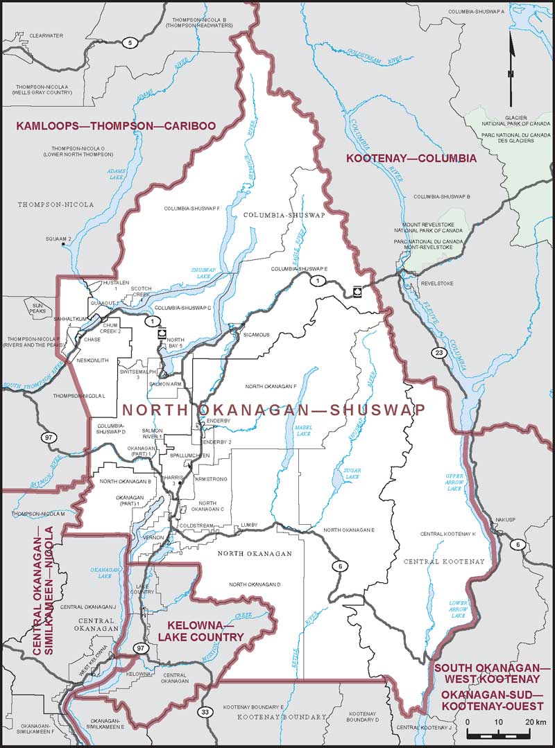
Boundaries description
Consisting of:
- (a) the Regional District of North Okanagan;
- (b) that part of the Regional District of Columbia-Shuswap comprised of:
- (i) the City of Salmon Arm;
- (ii) the District Municipality of Sicamous;
- (iii) subdivisions C, D, E and F;
- (iv) the Indian reserves of Chum Creek No. 2, Hustalen No. 1, North Bay No. 5, Okanagan (Part) No. 1, Quaaout No. 1, Salmon River No. 1, Scotch Creek No. 4, Switsemalph and Switsemalph No. 3;
- (c) those parts of the Thompson-Nicola Regional District comprised of:
- (i) the Village of Chase;
- (ii) that part of Subdivision L lying northeasterly of a line described as follows: commencing at the northwesterly corner of Subdivision D of the Columbia-Shuswap Regional District at approximate latitude 50°34'29"N and longitude 119°39'00"W; thence northwesterly in a straight line to the most southerly corner of Neskonlith Indian Reserve;
- (iii) that part of Subdivision P lying easterly of a line described as follows: commencing at the intersection of the South Thompson River with the northwesterly production of the southwesterly boundary of Neskonlith Indian Reserve; thence northwesterly along said production to the southerly production of the easterly limit of Subdivision O of the Thompson-Nicola Regional District at approximate latitude 50°45'24"N and longitude 119°48'04"W; thence northerly along said production to the southerly limit of Subdivision O at approximate latitude 50°55'29"N and longitude 119°48'16"W;
- (iv) Neskonlith Indian Reserve and Sahhaltkum Indian Reserve No. 4; and
- (d) that part of the Regional District of Central Kootenay comprised of that part of Subdivision K lying westerly of the Columbia River.